nwSnowboarding.com 2.1
Forecasts
Issued by: National Weather Service Seattle, WA
Last Update: 236 AM PDT Tue Jul 21 2026
Tonight: Mostly clear. Patchy smoke in the evening. Freezing level near 14500 feet. Lows in the lower 60s. Light wind.
Wednesday: Sunny. Freezing level near 15000 feet. Afternoon pass temperatures in the upper 80s. Light wind.
Wednesday Night: Partly cloudy. Freezing level near 15000 feet. Lows in the mid 60s. Light wind.
Thursday: Partly sunny. A chance of showers in the morning, then a slight chance of showers in the afternoon. Snow level near 12500 feet. Afternoon pass temperatures in the upper 70s. Light wind.
Thursday Night: Partly cloudy. A slight chance of showers in the evening. Snow level near 12500 feet. Lows in the upper 50s.
Friday: Sunny. Freezing level near 14500 feet. Afternoon pass temperatures in the lower 70s.
Friday Night: Mostly clear. Freezing level near 14500 feet. Lows in the mid 50s.
Saturday: Mostly sunny. Freezing level near 13000 feet. Afternoon pass temperatures in the upper 60s.
Saturday Night: Partly cloudy. A slight chance of showers. Snow level near 9500 feet. Lows in the lower 50s.
Sunday: Mostly sunny. A slight chance of showers in the afternoon. Snow level near 9500 feet. Afternoon pass temperatures in the upper 60s.
Sunday Night: Partly cloudy. Freezing level near 12500 feet. Lows around 50.
Monday: Mostly sunny with a slight chance of showers. Snow level near 9000 feet. Afternoon pass temperatures in the upper 60s.
Issued by: National Weather Service Pendleton, OR
Last Update: 2:02 am PDT Jul 21, 2026
Tuesday: Patchy smoke. Mostly sunny, with a high near 89. Calm wind becoming west around 6 mph in the afternoon.
Tuesday Night: Patchy smoke. Mostly cloudy, then gradually becoming clear, with a low around 62. Calm wind.
Wednesday: Patchy smoke. Sunny, with a high near 91. Calm wind becoming west around 6 mph in the afternoon.
Wednesday Night: Partly cloudy, with a low around 63. Northwest wind around 6 mph becoming calm in the evening.
Thursday: A 20 percent chance of showers. Mostly sunny, with a high near 82.
Thursday Night: Mostly clear, with a low around 57.
Friday: Sunny, with a high near 76.
Friday Night: Mostly clear, with a low around 54.
Saturday: Sunny, with a high near 70.
Saturday Night: Partly cloudy, with a low around 52.
Sunday: Mostly sunny, with a high near 70.
Sunday Night: Partly cloudy, with a low around 51.
Monday: Mostly sunny, with a high near 69.
47.41°N 121.41°W (Elev. 2812 ft)
Issued by: National Weather Service Seattle, WA
Last Update: 11:26 pm PDT Jul 20, 2026
Tuesday: Patchy smoke. Partly sunny, with a high near 87. Calm wind becoming west around 6 mph in the afternoon.
Tuesday Night: Mostly cloudy, then gradually becoming clear, with a low around 62. West wind around 6 mph becoming calm in the evening.
Wednesday: Sunny, with a high near 89. Calm wind becoming west around 6 mph in the afternoon.
Wednesday Night: Mostly cloudy, with a low around 64. West wind 5 to 7 mph becoming calm in the evening.
Thursday: A 20 percent chance of rain. Partly sunny, with a high near 78.
Thursday Night: Partly cloudy, with a low around 57.
Friday: Sunny, with a high near 74.
Friday Night: Mostly clear, with a low around 54.
Saturday: Sunny, with a high near 69.
Saturday Night: Partly cloudy, with a low around 51.
Sunday: Mostly sunny, with a high near 68.
Sunday Night: Partly cloudy, with a low around 50.
Monday: Mostly sunny, with a high near 67.
47.75°N 121.09°W (Elev. 4879 ft)
Issued by: National Weather Service Seattle, WA
Last Update: 11:26 pm PDT Jul 20, 2026
Overnight: Mostly cloudy, with a steady temperature around 65. Southeast wind around 6 mph.
Tuesday: Patchy smoke after 7am. Partly sunny, with a high near 79. Calm wind becoming south southwest 5 to 8 mph in the afternoon.
Tuesday Night: Partly cloudy, with a low around 63. West wind around 5 mph becoming light and variable.
Wednesday: Sunny, with a high near 80. Calm wind becoming west 5 to 8 mph in the afternoon.
Wednesday Night: Partly cloudy, with a low around 65. West wind 5 to 8 mph becoming light and variable in the evening.
Thursday: Mostly sunny, with a high near 69.
Thursday Night: Partly cloudy, with a low around 59.
Friday: Mostly sunny, with a high near 66.
Friday Night: Partly cloudy, with a low around 55.
Saturday: A slight chance of rain after 11am. Mostly sunny, with a high near 63.
Saturday Night: A chance of rain. Mostly cloudy, with a low around 51.
Sunday: A chance of rain. Partly sunny, with a high near 60.
Sunday Night: A chance of rain. Partly cloudy, with a low around 50.
Monday: A chance of rain. Partly sunny, with a high near 61.
48.86°N 121.68°W (Elev. 4265 ft)
Issued by: National Weather Service Seattle, WA
Last Update: 11:26 pm PDT Jul 20, 2026
Tuesday: Patchy smoke before 8am, then patchy smoke after 10am. Partly sunny, with a high near 79. Light and variable wind becoming northwest 5 to 8 mph in the afternoon.
Tuesday Night: Mostly cloudy, then gradually becoming mostly clear, with a low around 59. North northwest wind 3 to 8 mph.
Wednesday: Sunny, with a high near 81. Light west northwest wind increasing to 5 to 9 mph in the afternoon.
Wednesday Night: Mostly cloudy, with a low around 59. West northwest wind 6 to 9 mph.
Thursday: A 40 percent chance of rain, mainly after 11am. Partly sunny, with a high near 69.
Thursday Night: Mostly clear, with a low around 52.
Friday: Sunny, with a high near 68.
Friday Night: Mostly clear, with a low around 49.
Saturday: Sunny, with a high near 65.
Saturday Night: Partly cloudy, with a low around 47.
Sunday: Mostly sunny, with a high near 63.
Sunday Night: Partly cloudy, with a low around 46.
Monday: Mostly sunny, with a high near 62.
46.93°N 121.49°W (Elev. 5233 ft)
WSDOT
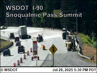
Snoqualmie Pass I-90
Road Condition: Reports have ended for this season. Traditionally weather and road conditions are reported on this page from November 1 to April 1. Should adverse weather occur that will impact travel, updates will be provided as information is available.Temp: 60°F
Weather: Travel impacts will be updated here if conditions cause delays of an hour or more. For other cross-state travel conditions, check WSDOT's real-time travel map.
Restrictions: No restrictions
⚠️ Travel Advisory Active
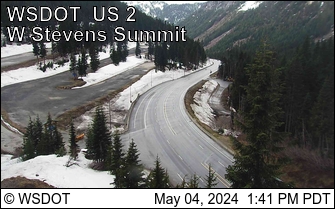
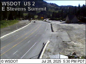
Stevens Pass US 2
Road Condition: Reports have ended for this season. Traditionally weather and road conditions are reported on this page from November 1 to April 1. Should adverse weather occur that will impact travel, updates will be provided as information is available.Weather:
Restrictions: No restrictions
⚠️ Travel Advisory Active
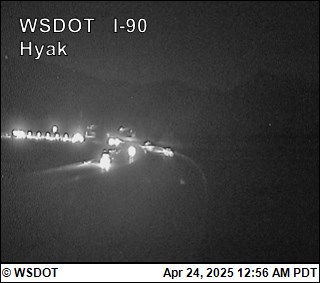
Webcams